

Indiana Glaciers
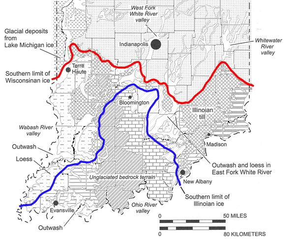 About 4 million years ago, the
late Cenozoic ice age began.
During an ice age, cyclic climate changes occur such that
snowfalls do not completely melt the following summer. Ice
sheets advance and retreat on temperate areas at intervals
of about every 100,000 years. These shorter events are
known as glaciations. The Illinoian glaciation
peaked ~220,000 years ago and its maximum southern extent
is indicated by the blue line at right. The Wisconsinan
glaciation (red) peaked about 20,000 years ago.
About 4 million years ago, the
late Cenozoic ice age began.
During an ice age, cyclic climate changes occur such that
snowfalls do not completely melt the following summer. Ice
sheets advance and retreat on temperate areas at intervals
of about every 100,000 years. These shorter events are
known as glaciations. The Illinoian glaciation
peaked ~220,000 years ago and its maximum southern extent
is indicated by the blue line at right. The Wisconsinan
glaciation (red) peaked about 20,000 years ago.
These events had a major impact on Indiana geology. Glacial sediments buried much of the karst present in the older limestones north of these glacial boundaries. Today, this buried karst supplies an important groundwater source. Glacial boundaries and their meltwaters also defined the current course of all the major rivers in Indiana.
For various reasons, the regions we now call the Mitchell Plateau and Crawford Upland were mostly spared glaciation. Where this exposed bedrock coincides with the Blue River and Sanders group limestones shown in the Stratigraphy slide, karst terrain displays its most extensive development.